Novapoint Geosuite
The complete solution for geotechnical engineers with design, construction, drawing production, 3D modeling and calculations.
Geosuite takes geotechnical solutions a step forward
Manage all your work in a fully collaborative BIM environment using Trimble Quadri. Take full control and get a holistic perspective of projects, moving geotechnics into a seamless world where data can be shared, wherever you are.

Review, Organize and Present
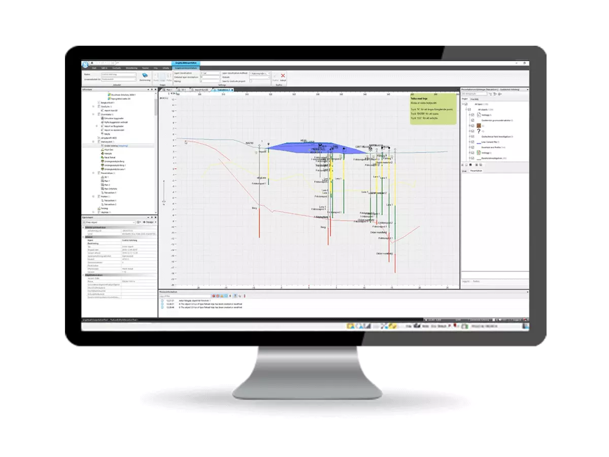
View and revise data from investigations and carry out calculations to understand soil properties. Easily organize and keep track of your projects while giving everyone a perfect overview of existing data and project status.

Collaborate in a Shared Model
Easily work with multiple teams in a BIM environment. Data can be shared with teams all over the world so that planners, designers, contractors, and project owners can have geotechnical data at their fingertips.

All-in-One Software
Read and edit data from soundings and sampling, manage and verify boreholes, create plan drawings, diagrams, 3D models, cross sections and profiles for your projects—all in one software.
Download the Latest Version
Trimble Novapoint Geosuite
Modules
.jpg)
Archive
Archive is the base module for organizing your projects, starting calculations and utilizing the other Geosuite modules. Export and import data to and from other databases and keep track of your project—while giving everyone a perfect overview

Presentation
Plan an investigation and easily create drawings and 3D models from all your soil/rock data, then present the results according to the Nordic standards (SGF/NGF).

Settlement
Using up to five soil models (Norwegian and Swedish) you can perform settlement calculations such as time modeling of pore pressure and stress generation from loads, including modeling over time.

Stability
Calculate slope stability using cross sections, 2D slope analysis, point loads and distributed loads, groundwater and pore water pressure, drained or undrained and sensitivity analysis.

Pile Group
Design and perform analysis of 3D pile groups with extensive modeling options for one or more piles, loads and soil profiles.

Supported Excavation
Use clear graphs to analyze excavation of sheet piles, and the results for each calculation step. Build a database for sheet piles and divide the excavation process into phases.

Soil Data Interpretation
Interpret soil properties graphically for investigations from CPT and analyze the data using statistical methods. Also investigate the soil stress history by displaying in-situ stresses, oedometer interpretations, OCR and much more.
Meet Our Customers
Learn how customers around the globe are using Trimble Technology to be more efficient and profitable.
Literature
pp_s_add_config
pp_literature
pp_s_documentation
pp_s_contact